
Interactive Gibraltar Map, 1880s
Multi-layer map on this website with a standard "Leaflet" webmap interface. Use the browser "back button" to return to this page from the map. See below for user instructions and layout.
Click on the above link or the image below and allow some time for the map to load; it has many layers. You may receive a message that a script is slowing down the webpage - ignore it.
The map will open in this browser window. To access the map directly from a browser go to
majortweedy.com/gibmap-5
Instructions
Below is a screenshot of the map upon opening.
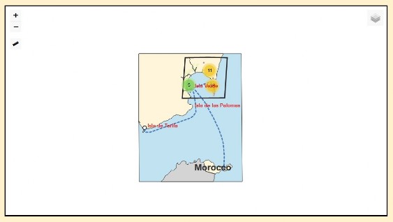
In the upper-left are the zoom buttons, . + . to zoom in, . - . to zoom out. You can also use the mouse scroll wheel to zoom. Below the zoom icons is the ruler icon. Click on it to measure distances.
In the upper-right is the layers menu icon.

Move the cursor over the layer menu icon and the menu will open. Check and uncheck the boxes (by clicking) to make a layer visible or invisible. Note that you can't reorder the layers.
To move the map in the browser window hold down the left mouse button and "drag" the map.
Map Layers
Base Maps
Town Plan 1865: 25" plan - Ordnance Survey.
Peninsula Chart 1886: 6" map - Admiralty.
Gibraltar Polygon
Spain Shaded Relief: This is a large image. It wil take some time for it to load fully.
Spain Polygon
Ceuta
Morocco
Roads
Lines showing roads and tracks.
Polygon Layers
Spanish Military
British Military
Royal Navy
Census Districts: Gibraltar areas not in a shown district are in District 10, South Division.
Places: Polygons for places of interest.
Land Use
Point Layers
Spanish Military
British Military
Ulysses: Places that appear in the novel.
Spanish Military
British Military
Spanish Town Plans
Algeciras
Campamento
La Linea
La Tunara
Mayorga
Palmones
San Roque
Tarifa
Feature Information
As you hover the "grabber" cursor over displayed layer features, it will change into a "pointer" cursor. If you then left-click the mouse a small window with information on that feature will pop up. Popup information is not available for base maps.

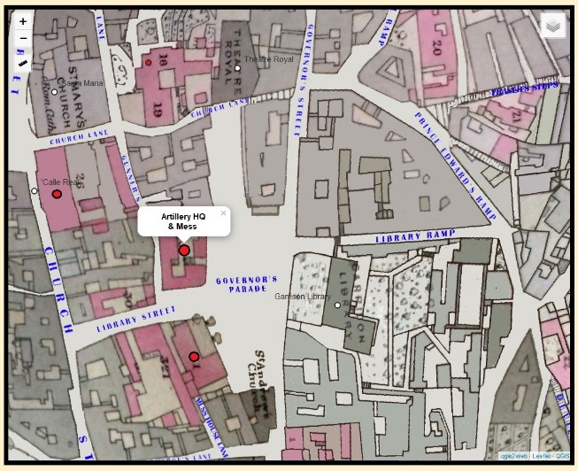
In the example illustrated above, the displayed feature layer is British Military Points.
The Spanish Town Plans
Most of the plans for the Spanish towns are from relatively small scale (1:25,000), mid-nineteenth century surveys of the countryside. The plan for San Roque is an interpolation from a small scale survey of 1872 and a town plan of 1905. The plan for La Linea is more of an "artist's rendition" than a cartographic work. It is an interpolation from 1872 and 1903 surveys. The Algeciras town plan is from an 1856 survey (1:10,000) checked agains a 1910 survey. Tarifa is from an 1882 survey of the town, Isla de Las Palomas, and the vicinity at 1:12,500. These surveys were by the Spanish Cuerpo de Ingenieros, British Admiralty, and British War Office.
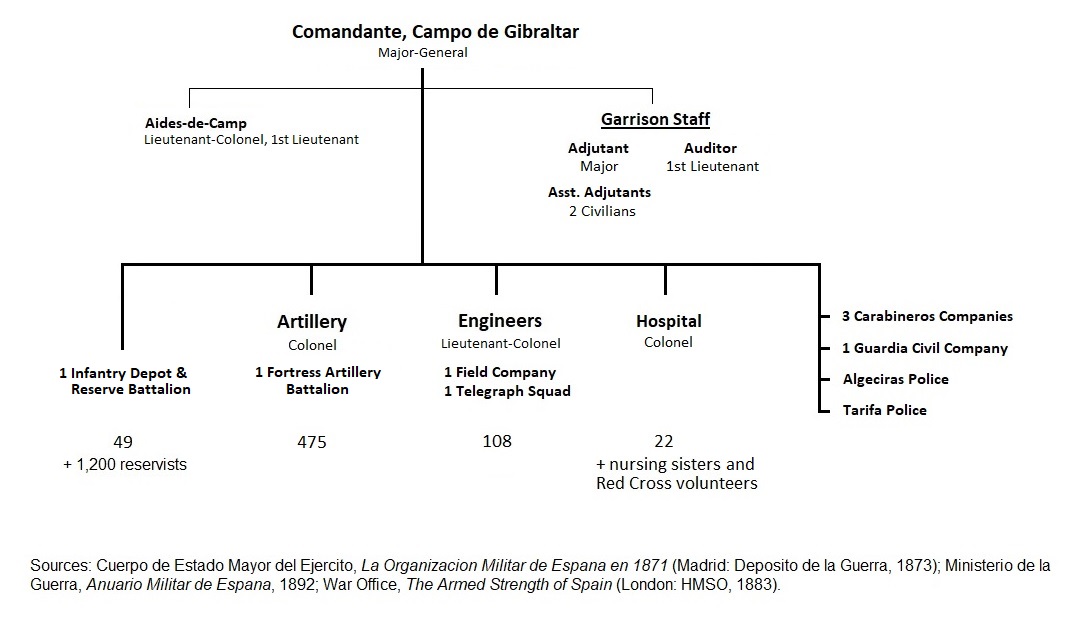
The Garrisons
British Gibraltar was first and foremost a fortress and was typically garrisoned with at least 5,000 troops. For the Spanish, the area around Gibraltar was a military zone (Campo de Gibraltar) ever since its conquest in 1704 by an Anglo-Dutch force. By the 1880s, the Campo encompassed about one-fourth of Cadiz Province and had a military governor. Spanish uniformed presence was light, with only about 700 troops. Spanish garrison towns were Tarifa, Algeciras, San Roque, and La Linea. Note that in 1883, there were no troops in San Roque and La Linea. By the end of the 1880s; however, a Spanish infantry regiment was stationed in the campo with HQ and 500 men at Algeciras, 200 men at San Roque, and 100 men at La Linea.
For organization charts of the garrisons, click on the following links and they will appear in popup windows (image files from this website).
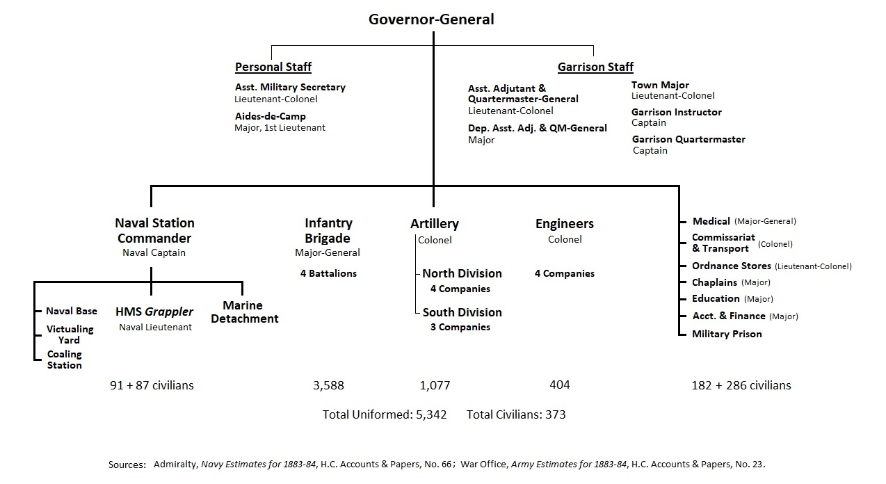
In early 1883, British infantry battalions in Gibraltar were 1/East Surrey Regiment, 1/Loyal North Lancashire Regiment, 2/Essex Regiment, and 2/Durham Light Infantry. They would later be joined by 2/Royal Dublin Fusiliers bringing garrison strength to 6,200 men, all ranks.
n/ Gibraltar Directory, 1883.
[ You are at www.majortweedy.com>Molly's Gibraltar> Interactive Map ]