Gibraltar Points of Interest in Ulysses
The images on this page show the Gibraltar sites noted in Ulysses with respect to the peninsula's topography. Such images give a better indication of the appearance of these points of interest than can be achieved by photographs and map markings. All images are photograph's of Warren's 1865 model of the colony.
Warren's Model of Gibraltar
From 1861 to 1865, Lieutenant Charles Warren, Royal Engineers, surveyed Gibraltar and with the assistance of Sergeant Turnbull and Sappers (privates) Williams and McLellan created two, eight-meter long scale models of the Rock. One was kept at Woolwich Arsenal, London, the other, which survives, is on display at the Gibraltar Museum. Both were painted in 1868 by Captain Benjamin Branfill, 86th (Royal County Down) Regiment of Foot.
Warren was on the half-pay, reserve list 1886 to 1889, when he served as Commissioner of the London Metropolitan Police. He retired from the army in 1897 with the rank of Lieutenant-General. Warren was recalled to the colours for the Second Boer War and in South Africa commanded the 5th Division. The War Office removed him from command in August 1900, after 10-months service, for failure to achieve satisfactory results.
All photographs on this page were taken by Jim Crone, Belfast, Northern Ireland, who graciously placed his work into the public domain.
n/ Gibraltar Directory and Guide, 1883; Chipulina, "Models of the Rock," People of Gibraltar, gibraltar-intro.blogspot.com/2014/09/models-of-rock-finding-time-from-days.html (will open in a new browser window); commons.wikimedia.org/wiki/File:Gibraltar_Model_1865_(1).jpg, et seq, Share Alike License.
Rock Face and Town, as Seen from Spain
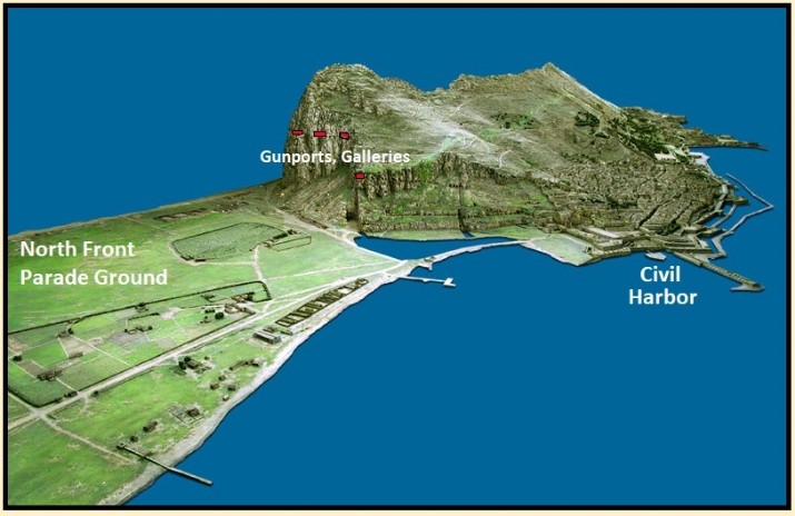
North End of Town
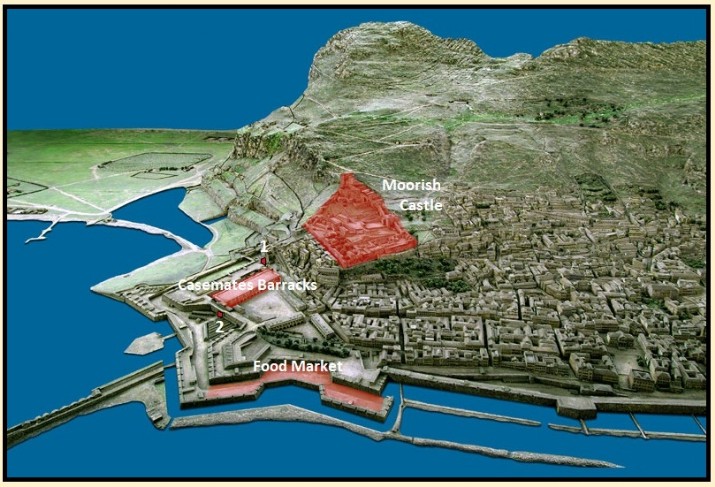
1. Landport Gate to the North Front and Spain.
2. Waterport Gate to the Civil Harbor and Food Market.
Town and Heights
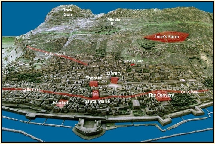
Rock Gun was the highest-placed artillery battery (6 guns).
The governor's residence, known as The Convent, was formerly a Franciscan friary.
Commercial Square had an open-air market where anything from a button to a bed was sold.
Calle Real was renamed by the British in segments (Waterport, Main, Church, and Southport Streets).
Alameda and Heights
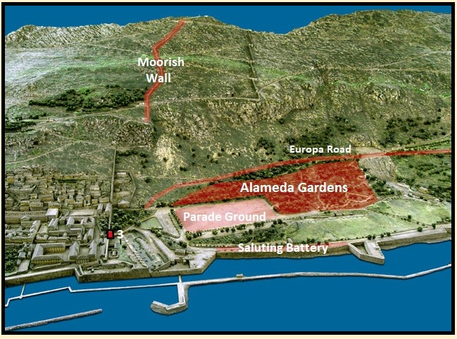
3. Southport Gate.
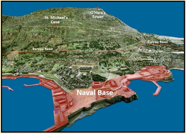
Rosia and Heights
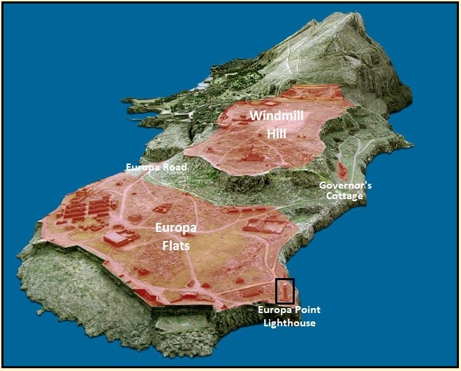
Windmill Hill, as Seen from the West
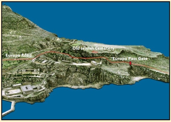
Peninsula's South End
East Side of the Rock, North of Windmill Hill
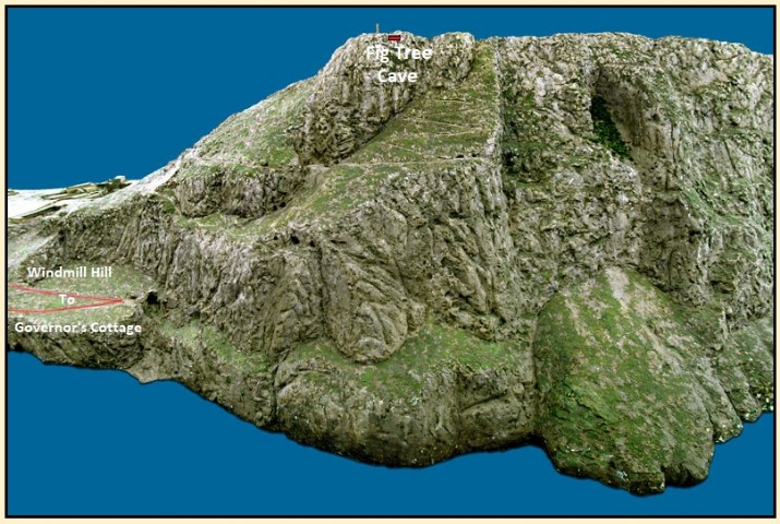
A "firtree cove" appears in Molly's memories of Gibraltar; however, there is no such place. Gifford believes this may be a reference to Fig-Tree Cave. The cave is accessed by a footpath, "The Mediterranean Steps," that runs down from the heights near O'Hara's Tower.
n/ U (Gabler) 18:790; Don Gifford with Robert J. Seidman, Ulysses Annotated (Berkeley: Univ. of Calif. Press, 1988), 622.
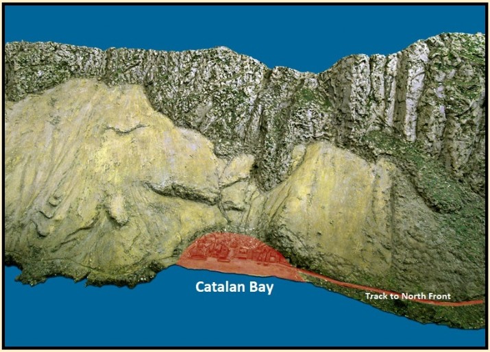
Catalan Bay
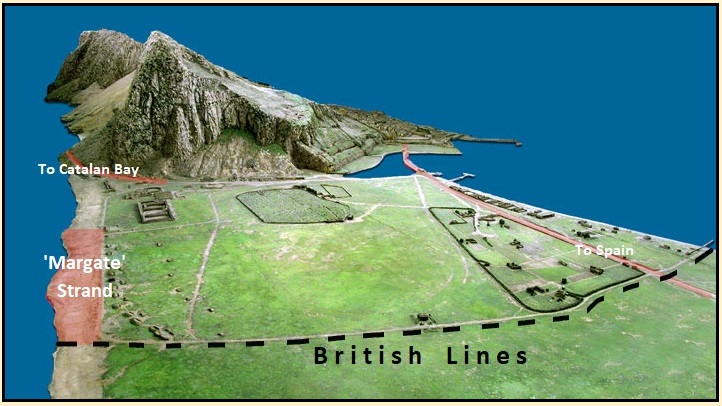
North Front, as Seen from Spain
Click on the above link and the download page on Wikimedia will open in a new browser window. On that page are links for each of the photos; resolution 800x572.

[ You are at www.majortweedy.com>Molly's Gibraltar>Ulysses References ]