
Ordnance Survey of Ireland
The first survey of Ireland was undertaken by the Royal Engineers from 1825 through 1842. Maps from this survey are known as "Original" or "1st Edition" maps. From 1855 through 1867, the cities and larger towns were resurveyed and the resulting maps are known as "1st Revision" or "2nd Edition" maps.
In 1870, the government transferred domestic survey responsibility from the War Office to the Office of Public Works. The Royal Engineers continued to participate in the work as it gave its uniformed personnel experience in peacetime. In Ireland, the military units involved in the surveys were the 16th Engineer Company (Belfast) and 14th Engineer Company (Dublin). Over 80% of the personnel involved in the surveys were civilians. The entire island was resurveyed between 1888 and 1913. The maps from that work are referenced "2nd Revision" or "3rd Edition."
After establishment of the Irish Free State in 1921, the civilian personnel of the Dublin office became employees of the new Ordnance Survey Ireland, a branch of the Department of Finance (click on the link and the OSI home webpage will open in a new browser window). The establishment's facility remained at Mountjoy Barracks in Phoenix Park, Dublin.
Ordnance survey maps usually have three dates: The original survey, the last revision before publication, and publication. The publication date is when the map was first sold to the public and can be many years after the last survey.
Standard Map Scales
Ratio 1: | Ordnance Survey Inches to Mile | Scale Category |
1,000,000 | Small | |
250,000 | 1/4 Inch | Medium |
126,720 | 1/2 Inch | Medium |
100,000 | Medium | |
63,360 | 1 Inch | Medium |
50,000 | Medium | |
25,000 | Large | |
10,560 | 6 Inch | Large |
10,000 | Large | |
2,500 | 25 Inch | Large |
1,250 | 50 Inch | Town Plan |
1,056 | 5 Feet | Town Plan |
Illustrated comparison of 1:1,000 (Town Plan), 1:2,500 (25 Inch), 1:10,560 (6 Inch), and 1:50,000 scales. In a 5.1 MB pdf prepared by the University College Dublin Library. Click on the above link and the file, from the UCD website, will open in a new browser window.
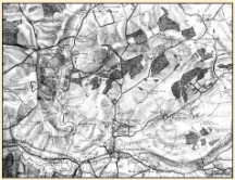
1" (1:63,360)
6" (1:10,560)
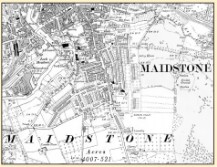
25" (1:2,500)

Legend for the 1" Maps and Characteristic Sheet for the 6" and 25" Maps. In a 489 kb pdf stored on this website. Click on the above link and the file will open in a new browser window.
Resources on Other Websites
Click on the link below to view the material. Webpages will open in new browser windows.
"Help for Researchers" by the British Library. Stored on the UK Web Archive.
Technical information on map scales, accuracy, and symbolization from the San Francisco Estuary Institute and Aquatic Science Center. Click on the icon to the right for the organization's website.
Illustrated indices for the 3rd Ed. 25" and 6" maps of Ireland. From the Internet Archive. You may download the entire book.